Sunday in San Francisco
I wrote a bit about the folks surfing the Golden Gate on Sunday in an earlier blog entry, but there was a lot more going on in the 49 square miles that is San Francisco.
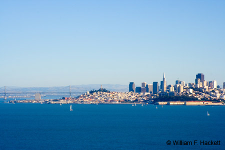
Traffic was deceptively light on I-580 and I-92 over the San Mateo Bridge, as well as on I-280 entering San Francisco from the south. I had decided to start photographing in Golden Gate Park, and the southern approach to “The City” is often less congested than the approach over the Bay Bridge. I have heard that the Bay Bridge Toll Plaza is the widest street in the United States at 20 lanes wide, but when I just tried to document it with a reference, I see that there is a lot of contention about wide streets. In any case, if you have a location with two large sports arenas joined by a bridge, it can be an area to avoid. Often, my trips to San Francisco start with parking my vehicle in Pleasanton and riding the BART (Bay Area Rapid Transit) train into “The City.”
Traffic changed remarkably when I left I-280 for Highway 1 and when I attempted to drive to Ocean Beach and the west end of Golden Gate Park. I had failed  to check the Internet for events in San Francisco, and there was a marathon and a half-marathon with 15,000 women, benefitting the Leukemia and Lymphoma Society. Golden Gate Park and Ocean Beach are along prime routes for foot races in San Francisco. After traveling north along streets that paralleled the race route, I reached Lincoln Way, where I traveled east and was able to enter Golden Gate Park at 25th.
I parked at the Polo Fields, knowing that any photography in the park that day would be done on foot, and hefted my backpack and tripod to take some photos of the soccer games in progress on the Polo Fields. From the west end of the Polo Fields, I walked north to take some photos of the stables and horses of the San Francisco Police Department. From there I walked a short distance west down a path to the somewhat secluded Angler’s Lodge (constructed in 1938) with its flycasting pools, which provides a location for flyfishing enthusiasts to practice their technique, using targets that look like floating concentric hula hoops!
After taking some photos at the flycasting pools and the lodge, I walked north to John F. Kennedy Drive and the Buffalo Paddock, but the bison were not feeling photogenic on Sunday. Bison were first brought to Golden Gate Park over 100 years ago as part of the effort to prevent the extermination of the largest land mammal of North America. If you are interested in bison, and the Watchbison Committee clearly is, their Web site provides many useful links.
I walked northeast along John F. Kennedy Drive and up a small incline to Spreckels Lake, where activities ranged from sailing radio-controlled sailboats to feeding pigeons and gulls to watching turtles sunning themselves to eating goodies from the vendor’s cart.
I just found an article written for the Mercury News, and the author shares my opinion that there are areas of Golden Gate Park that are tucked away like golden nuggets waiting to be discovered. I felt that way myself when I first walked around Strawberry Hill in the middle of Stow Lake.
From Spreckels Lake, I hiked back to my vehicle and, since the foot race was still going on, drove east on Middle Drive West, north on Crossover Drive to the edge of the park, and north on 25th. I attempted to stop at Baker Beach, which affords wonderful views of the Golden Gate Bridge, but the parking lot was full, since it was sunny with temperatures in the low 70’s ℉. I drove from there to Fort Point (under the southern end of the Golden Gate Bridge), where I photographed the surfers described earlier.
I crossed the Golden Gate Bridge in the “free” direction (northbound) leaving San Francisco, and stopped at the scenic vista on the Marin side to take a few photos. From there I traveled Highway 1 past Muir Beach and the turnoff to Muir Woods, up the hill to the Muir Beach Overlook, which housed spotters in fortified locations during World War II. There are steps and railings (be careful with your footing and children!) down to the overlook, where, on a clear day, you can see Ocean Beach to the South, Bolinas and Point Reyes to the north, the top of Mount Tamalpais to the east, and all the way to the Farallon Islands to the west.
I drove back to Livermore (using the Richmond-San Rafael Bridge in the free [eastbound/southbound] direction) after a rich, full day with 4 GB of memory cards almost completely full. Now comes the tough part, since I estimate about 3 hours of post-processing of the RAW images for every hour in the field. This is the “craftsmanship” part of digital photography, a part that is missed (sometimes gleefully ) by folks just taking “snapshots” as JPEG images and posting them on the web. The rewards of shooting RAW are worth the effort, of course, in the quality of the final product, since all digital cameras are capable of making *really bad* decisions in the creation of JPEG images. Many/most/all of these decisions can be made better by trained photographers shooting camera RAW files and processing the files with suitable image software. Try shooting RAW (if you are not already) and reading manuals and books a lot! Let me know if you like the results!
-Bill at Cheshire Cat Photo™
You can view higher-resolution photos (*generally* 7-30 megabytes, compressed) at the Cheshire Cat Photo™ Pro Gallery on Shutterfly™, where you can also order prints and gifts decorated with the photos of your choice from the gallery. Apparel and other gifts decorated with some of our most popular photos can be ordered from the Cheshire Cat Photo™ Store on CafePress®.


