Offshore oil drilling map link
I wanted to pass along THIS link to a CNN map of the continental United States and Alaska with color-coded areas:
1) where oil drilling is occurring today
2) that are available for drilling today
3) that are NOT available for drilling but would be if the federal ban on offshore drilling were lifted
4) of National Marine Sanctuaries where no drilling is allowed
The map is important because the discussion of offshore drilling is not just a “California thing.” The areas covered under point #3 include virtually the entire east and west coasts (except for marine sanctuaries) and Florida’s Gulf Coast as well.
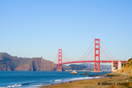
Another important point is that oil does not stay where it is spilled. The 54,000 gallons of oil that spilled from the Cosco Busan container ship into San Francisco Bay last fall did not even stay in San Francisco Bay after the ship struck the fender of a support tower of the Bay Bridge. Oil spread to various parts of the Bay and up and down the coast outside of the Golden Gate. (See this page of the Department of Fish and Game Site for a map [which can be enlarged] and links to a number of relevant reports on environmental impacts.)
The fact that oil spills do not “stay put” means that they can wander into National Marine Sanctuaries, as some of the oil from the Cosco Busan did. From the map on the CNN page, it looks as though sanctuaries in California, Florida and the Keys, as well as in Washington state, could be exposed to additional risk from the oil drilling and operations. The spills can also wander into areas of fishing, recreation, and tourism.
You folks on the East Coast, from the northern half of Florida to Maine, can look at the map and see what you think from your perspective, and from your knowledge of currents, winds, and tides.
Is the potential benefit at some future date worth the risks (not just to marine life and fisheries, but also to travel and tourism)? Folks have to make that decision for themselves. It is obvious that offshore drilling in the currently banned areas is something that “Big Oil” wants very badly.
I, for one, remain unconvinced by their arguments.
-Bill at Cheshire Cat Photo™
You can view higher-resolution photos (*generally* 7-30 megabytes, compressed) at the Cheshire Cat Photo™ Pro Gallery on Shutterfly™, where you can also order prints and gifts decorated with the photos of your choice from the gallery. Apparel and other gifts decorated with some of our most popular photos can be ordered from the Cheshire Cat Photo™ Store on CafePress®. Both Shutterfly™ and CafePress® ship to most international locations worldwide! If you don’t see what you want or would like to receive an email when new photos are up on the site, send us an email at info@cheshirecatphoto.com.


